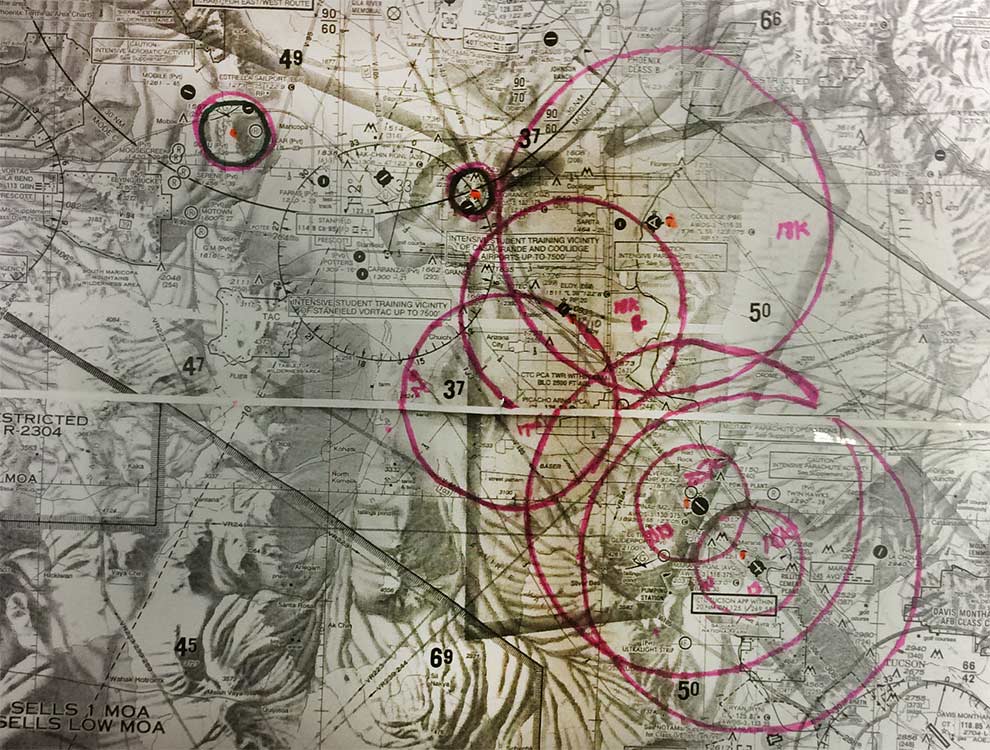
Parachute areas in PHX area, as derived from 2016 Chart Supplement. (Courtesy of Terry Brandt.)
New ways to visualize information in the newly renamed Chart Supplements — formerly the Airport Facility Directories — comes to light with the ability to find parachute areas in any given region.
AFTW’s Terry Brandt recently did that by drawing out the areas, by hand, on a chart. The information was compiled for the Chart Supplement covering the PHX area, plus the NOTAMS covering this region, as well.
You can download a PDF of his work here. (Be advised, this is a 20MB download, and it might take a while on slower computers.)
Thanks, Terry!
You must be logged in to post a comment.